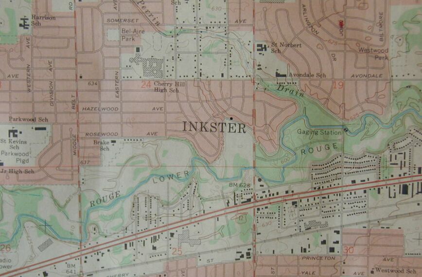
| This is a Quadrangle map of the Inkster Michigan area. The dot in the center shows where our house is situated on the north end of the park, just above the "E" in Inkster. Inkster Road is the red/white line running north/south. Michigan Avenue (US-12) is the divided highway running east/west. To judge distances, it is one mile between Inkster Road and Middlebelt Road to the west. Avondale School is my Kindergarten school. St. Norberts is my grade school and "Shared Time" high school. Cherry Hill High School was the other "shared" part. |